Mount Timpanogos is a 11,749 foot tall peak that looms over Provo with incredible 360 degree views, stunning landscape, an alpine lake, fall foliage, and even a summit wind shelter. Here’s everything you need to know to hike Mount Timp.
Quick Navigation:
Trail Map | Trails | Hiking In Winter | Camping | Weather | Directions | Pictures
Difficulty – Strenuous
Distance – 14.2 miles round trip (22.85 km)
Height – 11,749 feet (3581.10 m)
Elevation gain – 5,065 feet (1544 m)
Duration – 8-10 hours (book time)
Trailhead Location – Timpooneke Trailhead (7,382 Feet) or Aspen Grove Trailhead (6,916)
Dogs – Are allowed on this trail
Need To Know Information
- Timpooneke Trailhead requires timed entry reservations during the summer months on weekends. You can make reservations and see details here.
- Dogs are allowed on this hike.
- There are two commonly used trailheads for this hike that are both explained below.
- The trailheads require paying a parking fee, or displaying a National Parks Pass (America the Beautiful Interagency Recreation Passes)
- This is a popular hike, and you will encounter people. Parking fills up extremely fast. It is common to need to arrive before 6 am, and even 5 am on the busiest weekends.
- Camping is common, as there are campgrounds near the trailheads. Camping information and regulations below.
- Fishing is allowed at Emerald Lake with a Utah Fishing License.
- There are other trailheads to get to this summit, but they are less common due to longer distances, and greater elevation gain. Generally, they are only done by more experienced hikers, and therefore, those hikers can source information themselves.
Trail Map
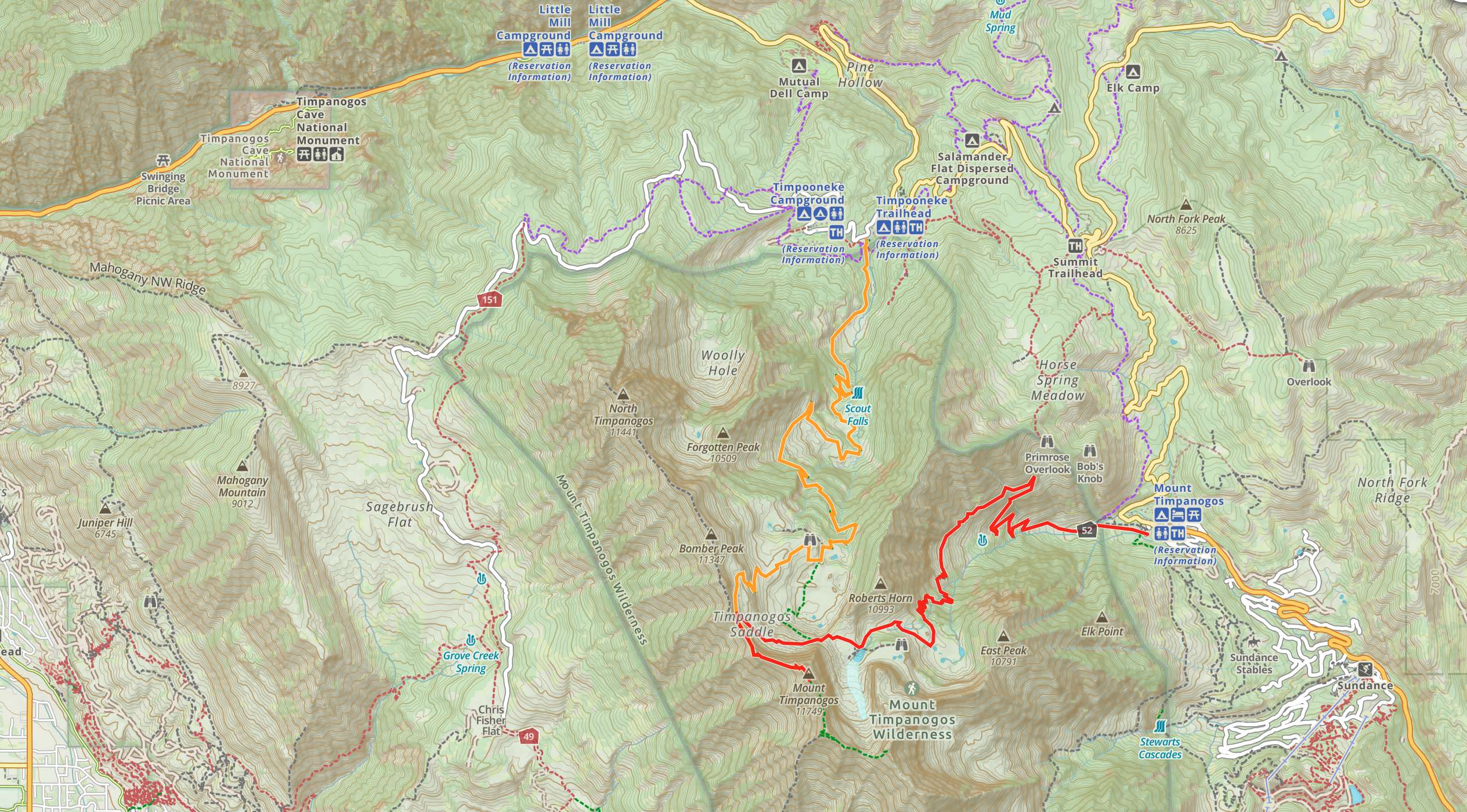
Mount Timpanogos Trail Map
Download GPX File For Timpooneke Trailhead
Download GPX File for Aspen Grove Trailhead
Routes
Mount Timpanogos Via Timpooneke Trailhead – 14.2 miles round trip (22.85 km) – 5,065 feet (1544 m) Elevation Gain
This is the most common route to the summit as it is the least amount of elevation gain. The trailhead is large, has vault style bathrooms, and a campground nearby. The trail is very well traveled and well marked. Hikers have a junction about 50 feet into the trail where they take the middle route staying on the Timpooneke Trail as marked by the signs.
From here, the hike gradually gains elevation. The trail is extremely easy to follow and well maintained. 1.4 miles in, hikers reach a small unmarked junction that takes them to Scout Falls. Simply turn hard right at this switchback as opposed to hiking to the falls and backs (unless you’d like to). From here, simply continue along the trail as it switchbacks at a constant gradient up the mountain.
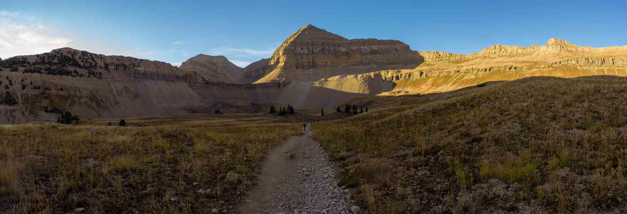
4.9 miles in, hikers reach Timpanogos Basin, where there is a junction heading into the basin towards the Emerald Lake Shelter, but hikers should go right towards the ridge to the right hand side of the Timpanogos Summit. Much of the route up to the pass can be seen from the basin.
Simply follow the switchbacks up to the ridge, and the well traveled path around the back side of the ridge and the summit of Timp. The trail is easy to follow, does feature some pretty steep drop offs, but the hike remains class 2 the entire time.
After reaching summit, hikers can retrace their steps back.
Mount Timpanogos Via Aspen Grove Trailhead – 14 miles round trip (22.53 km) – 5,697 feet (1736 m) Elevation Gain
This is the second most common route to the summit, and also has a campground and vault toilets at and near the trailhead. This route is a touch longer to complete due to the additional 500+ feet of elevation gain and similar mileage.
Similarly to the other route, hikers start on very well marked and maintained trail and continue along the Mount Timpanogos Trail towards Emerald Lake. This route takes hikers right to Emerald Lake shelter, before hikers head across the basin, and end up meeting up with the Timpooneke Trailhead route.
Mount Timpanogos Loop
There are a few loop options worth pointing out. Hikers could spot cars if they come in a group, and hike up one trail, and out the other. This is a great way to experience both trails.
In addition, there is an “expert” route where hikers glissade down to Emerald Lake from the saddle between Mount Timpanogos and South Timpanogos. This is not a recommended route unless hikers have the proper equipment, the right conditions, and knowledge of glisading.
Hiking in Winter
Mount Timpanogos is commonly hiked in winter by those with substantial experience. This hike requires winter hiking / climbing gear, and lots of knowledge. Winter conditions persist in spring and fall frequently, and even hikers taking the standard routes should bring microspikes or even ice axes at certain times of the year.
Camping Information
There are several common campground utilized in the area. There is a campground at both major trailhead:
Timpooneke Campground: Reservations and other information here.
Aspen Grove Campground: Reservation and other information here.
There is also an additional nearby campground called the Altamont Group Campground: Reservation and other information here.
In addition to the campground, Mount Timpanogos is located in the Mount Timpanogos Wilderness, which means camping is allowed as long as regulations are followed for camping in the Wilderness. Here is a page with the rules and regulations.
Fishing Emerald Lake
This lake does have fish that can hold year round. This is a catch and release fishery, but many anglers can have success on most days on any of the lakes.
Weather
Here is a detailed weather forecast for the area:
Lindon, UT
Overnight
Mostly clear, with a low around 20. Wind chill values as low as 9. Northwest wind around 9 mph.
Sunday
Sunny. High near 30, with temperatures falling to around 25 in the afternoon. Wind chill values as low as 9. North northwest wind 2 to 9 mph.
Sunday Night
Partly cloudy, with a low around 22. North northeast wind around 7 mph.
Monday
Mostly sunny, with a high near 33. North northwest wind 2 to 8 mph.
Monday Night
Partly cloudy, with a low around 21. North northeast wind 3 to 8 mph.
Tuesday
Mostly sunny, with a high near 30.
Tuesday Night
Mostly clear, with a low around 20.
Directions & Parking Information
To Timpooneke Trailhead:
If the Timpooneke lot is full, you can drive up the campground road and find Timpooneke Road. This is a dirt road in which you are allowed to park as long as you leave ample space for cars to pass. Parking at the campground will get you ticketed or towed.
To Aspen Grove Trailhead:
If the parking is full here, there is an Alpine Loop road in which parking is allowed at the turnouts. Again, do not park at the campground or at the Aspen Grove Alumni Resort as you will be ticketed or towed.
Additional Pictures
Views south towards Mount Nebo
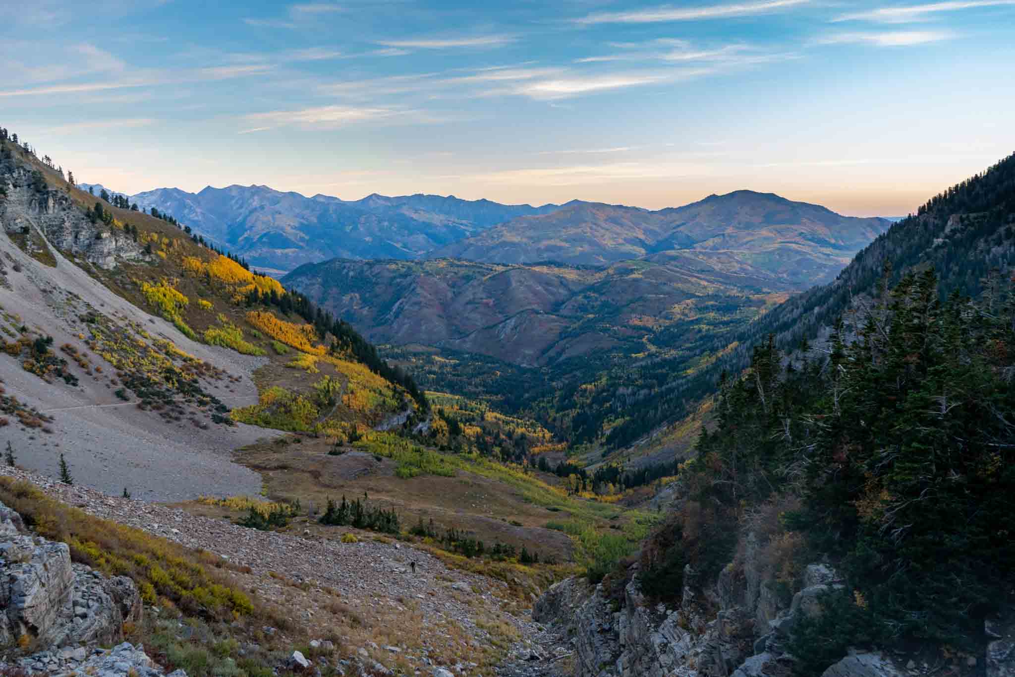
Looking back towards the Timpooneke Trailhead

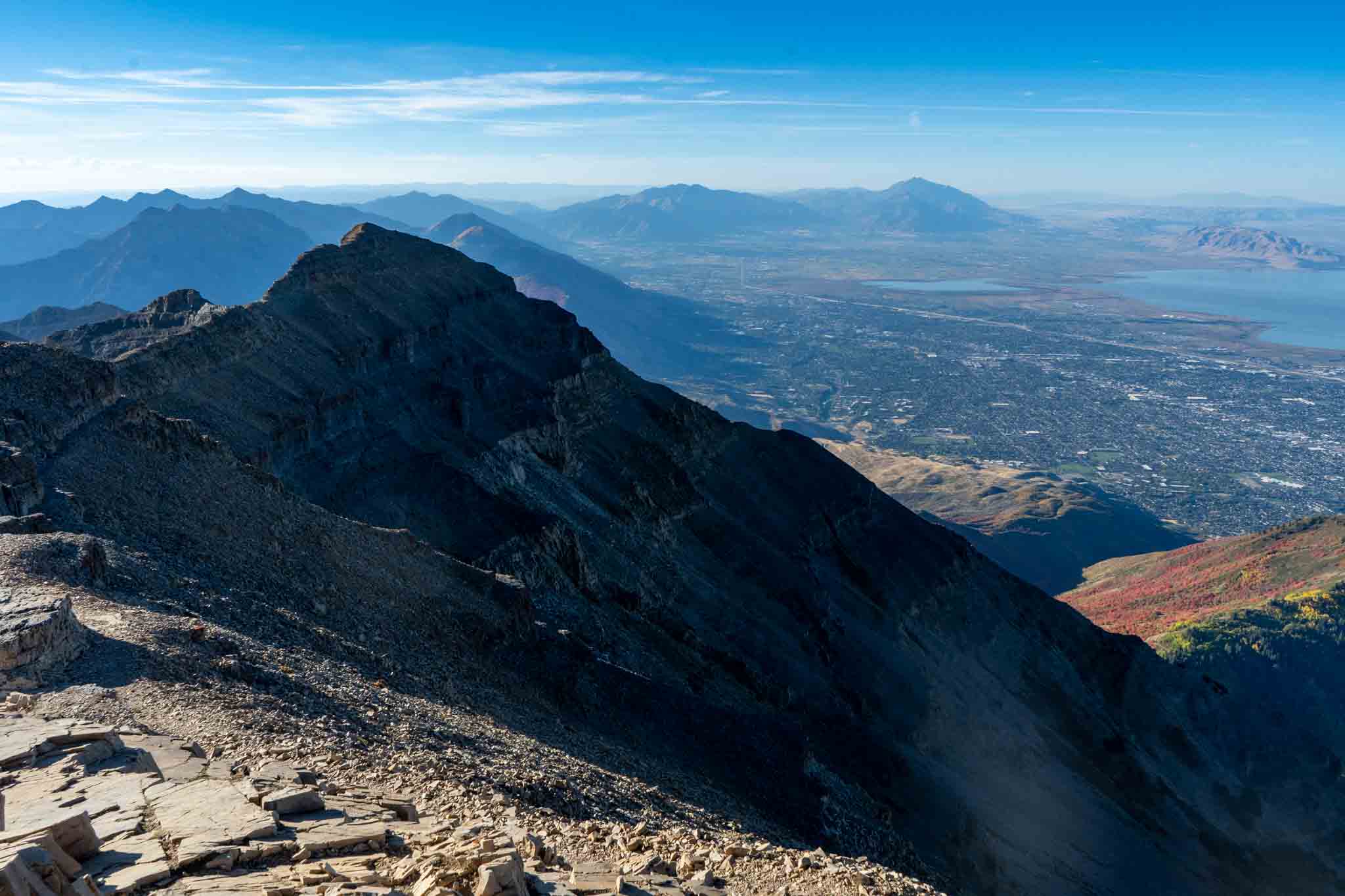
Views looking North towards Salt Lake City and Lone Peak
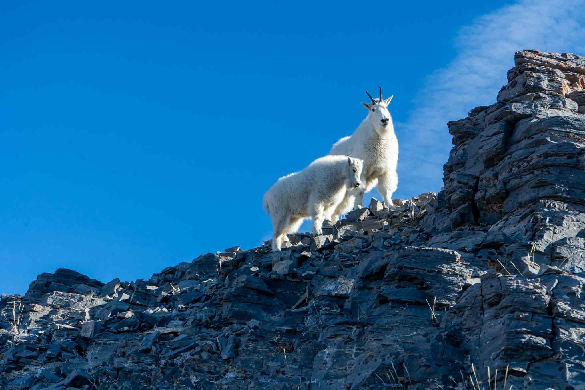
Mountain goats on Timp
Mount Timpanogos
Max DesMarais is the founder of hikingandfishing.com. He has a passion for the outdoors and making outdoor education and adventure more accessible. Max is a published author for various outdoor adventure, travel, and marketing websites. He is an experienced hiker, backpacker, fly fisherman, backcountry skier, trail runner, and spends his free time in the outdoors. These adventures allow him to test gear, learn new skills, and experience new places so that he can educate others. Max grew up hiking all around New Hampshire and New England. He became obsessed with the New Hampshire mountains, and the NH 48, where he guided hikes and trail runs in the White Mountains. Since moving out west, Max has continued climbed all of the Colorado 14ers, is always testing gear, learning skills, gaining experience, and building his endurance for outdoor sports. You can read more about his experience here: hikingandfishing/about
Perfect Sunrise This Morning
This morning it was gorgeous up high. Super clear, great sunrise, and quite warm overnight. We camped out below and hit the Timp summit for sunrise. We skied both last night and this morning on the glacier as well. Tons of other people with the same plans, but still an awesome time.
Perfect Weather & Views
Definitely arrive early for parking concerns, but such an epic hike on every single level!