Gobblers Knob in Big Cottonwood Canyon just outside Salt Lake City, Utah with one of the most memorable mountain names you’ll come across. There are two common starting points for this hike, and we provide you with all of the information you need to hike this mountain.
Quick Navigation:
Trail Map | Trails | Hiking In Winter | Camping | Weather | Directions | Pictures
Difficulty –Strenuous
Distance – 7.84 miles round trip (12.6 km)
Height – 10,220 feet (3115 m)
Elevation gain – 3,364 feet (1025 m)
Duration – 5-6 hours (book time)
Trailhead Location – Butler Fork trailhead (7,172 Feet) – Secondary Trailhead: Alexander Basin Trailhead (7,193 Feet)
Dogs – Not allowed from Butler Fork, Allowed From Alexander Basin
Need To Know Information
- Dogs are not allowed in Big Cottonwood Canyon. If hiking with a dog, hikers will need to leave from Millcreek Canyon at the Alexander Basin Trailhead.
- There are a few common routes. The most common is from the Butler Fork Trailhead which is the easiest route, the second most common is from Millcreek Canyon at the Alexander Basin Trailhead. The shortest distance route from Alexander Basin Trailhead is quite steep, and we would recommend talking the longer route from that side if you don’t like steep trails with loose dirt.
- Millcreek Canyon has a day fee. You’ll have to pay a day fee ($5) exiting the canyon, or have a yearly pass.
My Experience
I love this hike. I’ve hit the summit of this mountain and Mount Raymond about half a dozen times now as a pit stop on a trail run, or ski touring in the winter. It is an awesome area because it generally is less traveled compared to more well known mountains, but still boasts fantastic 360 degree views of the Wasatch. The easy access from either Millcreek Canyon or from Big Cottonwood canyon is great, and the foliage peeping in this area is also fantastic.
Trail Map
Here is a link to the trail route from Alexander Basin (Millcreek Canyon)
Here is a link to the trail route from Alexander Basin via the steeper, less recommended trail
Here is a link to the trail route from Butler Fork (Big Cottonwood Canyon)
Routes
Gobblers Knob Via Butler Fork
Distance – 7.84 miles round trip (12.6 km)
Height – 10,220 feet (3115 m)
Elevation gain – 3,364 feet (1025 m)
Trailhead Location – Butler Fork Trailhead
This is my favorite route to the summit because it routes hikers through gorgeous aspen groves, and just a short added summit of a peak called “Circle All”. Circle all has gorgeous views, and is a popular backcountry skiing peak. This route maintains a pretty steady incline before reaching the saddle next to Circle All. From here, hikers traverse across Mill A Basin (the basin between Mount Raymond and Gobblers Knob). This basin is easy to travel, but hikers pass through very large avalanche paths, where in the winter, hikers absolutely must understand avalanche dangers, and in spring, trees and avalanche debris may cross the trail.
If you are interested in this route, we have created a GPX route of it here.
Gobblers Knob Via Alexander Basin
Distance – 9.04 miles round trip (14.548 km)
Elevation gain – 4,172 feet (1301.50 m)
Duration – 7-8 hours (book time)
Trailhead Location – Here is a link to the trail route from Alexander Basin
This is also a fantastic route to the summit that takes you from Millcreek Canyon. The hiking in the woods is gorgeous and contains gradual, and well maintained trails the entire distance. This is a great route for those with dogs.
If you are interested in this route, we have created a GPX route of it here.
Hiking in Winter
This is prone to avalanche conditions in winter and should only be done by those who are aware of current avalanche conditions, and are prepared for winter hiking. This is a common backcountry skiing zone, but because of the avalanche dangers, this zone should only be done by those with experience in avalanche terrain. You can read the current avalanche forecasts on the Utah Avalanche Center website.
Camping Information
Backcountry camping is allowed in Big Cottonwood canyon pending you are on Forest Service property. Camping must be at least 1/2 mile off of any road, and 200 feet from any trails, water, or developed areas.
If approaching from Millcreek, you can backcountry camp. More information can be found here.
Weather
Here is a detailed weather forecast for the area:
Alta, UT
Today
Sunny. High near 33, with temperatures falling to around 25 in the afternoon. North northwest wind around 3 mph.
Tonight
Mostly clear. Low around 14, with temperatures rising to around 17 overnight. East northeast wind around 3 mph.
Monday
Mostly sunny. High near 34, with temperatures falling to around 28 in the afternoon. Wind chill values as low as 10. Northeast wind around 3 mph.
Monday Night
Partly cloudy, with a low around 22. East northeast wind around 3 mph.
Tuesday
Sunny, with a high near 35. Northwest wind around 3 mph.
Tuesday Night
Mostly clear, with a low around 21.
Wednesday
Sunny, with a high near 32.
Directions
To Big Cottonwood Canyon Trailhead at Butler Fork Trailhead
To Millcreek Canyon Trailhead at Alexander Basin Fork Trailhead
Additional Pictures
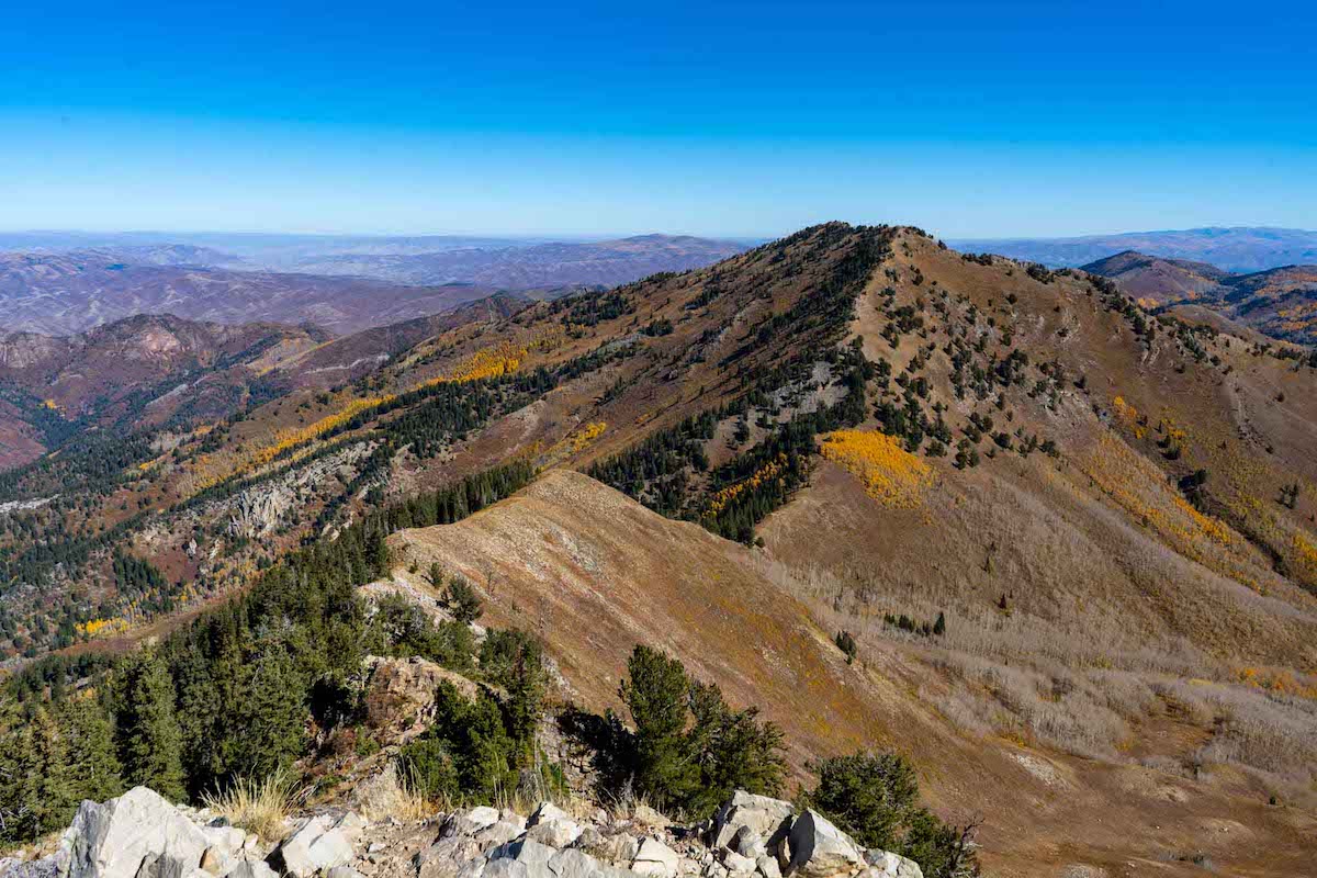
Gobblers Knob as seen from the summit of Mount Raymond
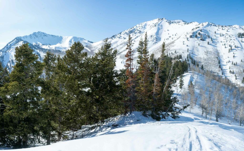
Gobblers Knob from Circle All Peak in winter

Views from summit of Gobblers Knob
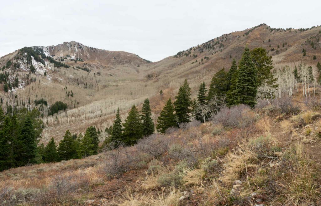
Views of Mill A Basin below Gobblers Knob and Mount Raymond
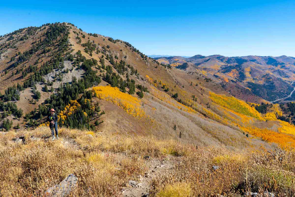
Views of Gobbler’s Knob on the ridge towards Mount Raymond
Max DesMarais is the founder of hikingandfishing.com. He has a passion for the outdoors and making outdoor education and adventure more accessible. Max is a published author for various outdoor adventure, travel, and marketing websites. He is an experienced hiker, backpacker, fly fisherman, backcountry skier, trail runner, and spends his free time in the outdoors. These adventures allow him to test gear, learn new skills, and experience new places so that he can educate others. Max grew up hiking all around New Hampshire and New England. He became obsessed with the New Hampshire mountains, and the NH 48, where he guided hikes and trail runs in the White Mountains. Since moving out west, Max has continued climbed all of the Colorado 14ers, is always testing gear, learning skills, gaining experience, and building his endurance for outdoor sports. You can read more about his experience here: hikingandfishing/about
Awesome Trail Run
Very few others around when I did a Butler Fork to Gobblers Knob, and then followed the ridge to the desolation trail before heading back to Butler Fork. Awesome conditions all around.
Awesome run before the snow comes!
Views not as great since all the foliage has fallen off! But still awesome to see snow in the higher peaks!