Pico Torrecilla is the highest peak in Sierra de las Nieves National Park. Sitting on protected land, this peak features incredible views of the towns of Yunquera and Tolox below, as well as views of the Strait of Gibraltar, and on a clear day, you can see all the way to Mulhacen, the highest peak in Sierra Nevada National Park. In this article, we are going to cover everything you need and want to know about this incredible mountain.
Distance – 14.6 miles round trip (23.5 km)
Height – 6,296 feet (1919 m)
Elevation gain – 3,917 feet (1194 meters)
Duration – 6-8 hours
Difficulty – Difficult
Trailhead Locations – Puerto Saucillo
Dogs: Allowed
Need To Know Information
- This hike is dog friendly.
- There are no reliable water sources on the hike, and this can be extremely hot territory, especially in the summer.
- This is high elevation and exposed to the weather, so always bringing a wind and waterproof layer is key. Even on the hottest days.
- In the months of January and February, it is very possible for their to be snowy conditions, and accumulated snow on the ground.
- Starting early is highly recommended.
Trail Map
We have created a map below of this route. This map has a GPX download button so that you can use that GPX file for any device or mapping software you’d prefer.
Directions & Parking
There are several different ways to summit Torrecilla, but only one common approach. Hikers start at Puerto Saucillo, or the slightly lower trailhead if the road is closed. There is not much parking, so during the peak seasons, it can get filled.
Bus System
There is a bus system that takes individuals from Ronda or Malaga to Yunquera.
Camping & Lodging
Camping is not allowed in this park. The best place to stay is the Town of Yunquera, where you can actually hike to the peak from. Hiking form the town will add about 3 hours round trip to your hike, so it is recommended to drive to the trailhead, or hire a taxi.
There is also a camping complex and hostel that is often used. Information on that can be found here.
Weather Forecast
Here is a great link for the summit forecast for Torrecilla
In addition, you should check the weather for down low in the town of Yunquera.
Land History
Sierra de las Nieves National Park was established in July of 2021 when it was further protected and upgraded from a Natural Park to a National Park. Torrecilla itself has been protected since 1995 as it has been recognized as an important biological area with over 1,500 recognized species of plants, many exclusive to the area, 120 species of birds, incredible cave networks, natural springs, towering peaks, and overall stunning terrain.
Torrecilla towers over some nearby historic, and beautiful towns, most notably the white homed villages, like nearby Yunquera and Tolox.
Route Description
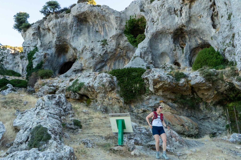
Hikers begin at Puerto Saucillo. It is possible that the road is closed to vehicles to Puerto Saucillo, in which case hikers would need to park at the lower gate, and simply hike the road up to Puerto Saucillo.
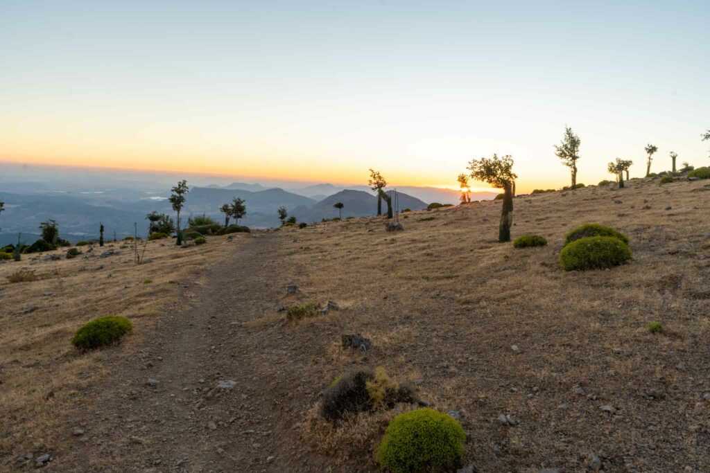
There is a sign with a map at Puerto Saucillo, where hikers begin in a forested trail from this trailhead. There are actually two options from the trailhead, one that takes hikers along the ridge, and one in the more forested sections, which is more traveled. We suggest staying in the forest to enjoy those trees and stay sheltered from the sun.
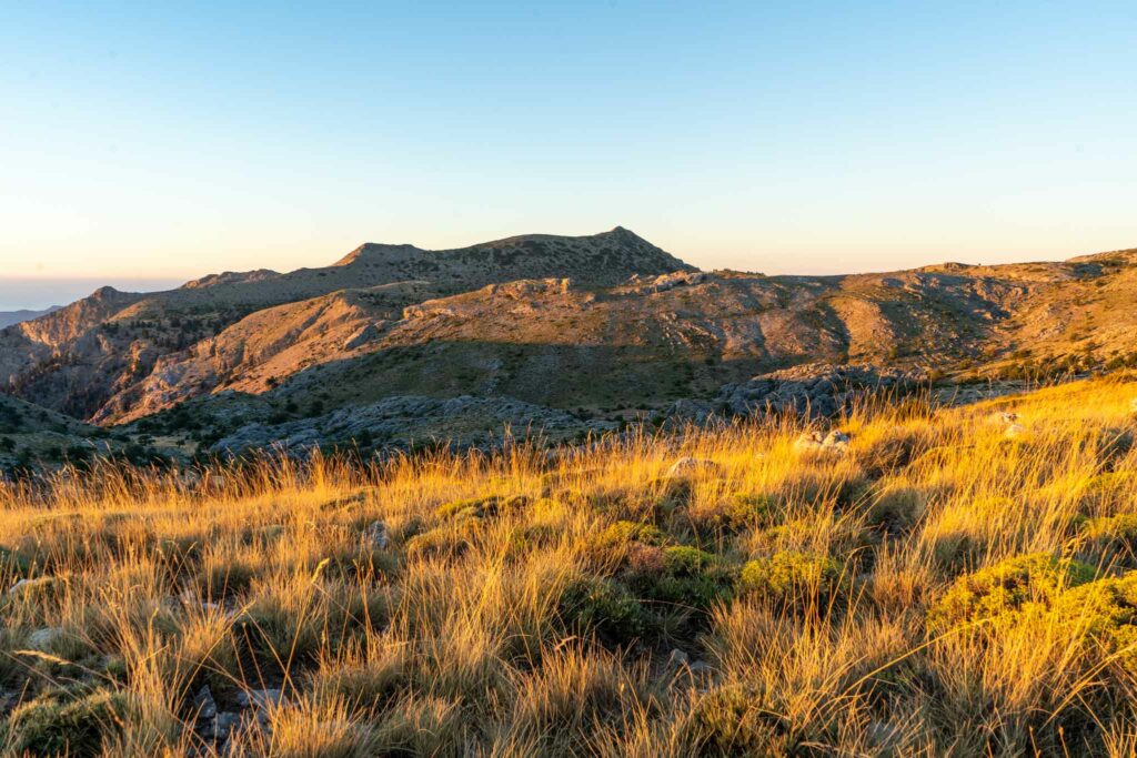
The trail is well traveled, simple, and easy to follow. It consistently gains elevation until hikers pass treeline, and can look back at Yunquera down below.
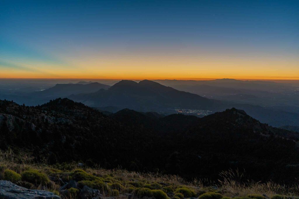
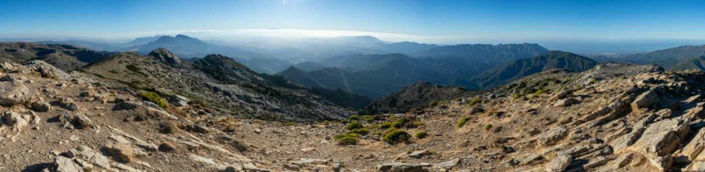
This image is taken just after getting above treeline at sunrise and seeing Yunquera down below with peaks of Prieta and Blancilla above. Hikers continue on the trail, and begin to start seeing all of the protected Pinsapo trees for the restoration effort in effect. The scale of this restoration is pretty incredible to see as you hike through the open area with thousands of Pinsapo trees.
Shortly after a large amount of Pinsapo Trees, hikers will head towards Peñon de los Enamorados, a nearby peak that can be seen from the trail. Hikers will reach a ridge where Torrecilla can be seen for the first time since starting the hike in the distance.
The first point in the hike where you can see Pico Torrecilla. The trail continues to be easy to follow, and you’ll see old aqueducts in various locations. From the this ridge, the hike is quite flat and loses elevation over the next couple of miles.

Hikers continue on the trail and get outstanding and unique views at various places.
Hikers eventually come across an old aqueduct at the base of the last push to the summit of Torrecilla. The last push to the summit is a relatively steep trail, but easy to follow and straightforward.
Views at the summit are incredible.
Overall, this hike is very straightforward, it is simply a relatively long distance, and features about 4,000 feet of elevation gain, making it quite a long day for most people. Do not take this mountain lightly, as the length, especially in the heat of the day, can be brutal. Be sure to bring enough water, over two liters per person. I’d recommend 3+ liters.
On our hike, we each took a 2 liter hydration bladder, and then a bottle of gatorade.
Torrecilla summit views
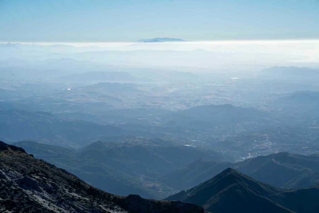
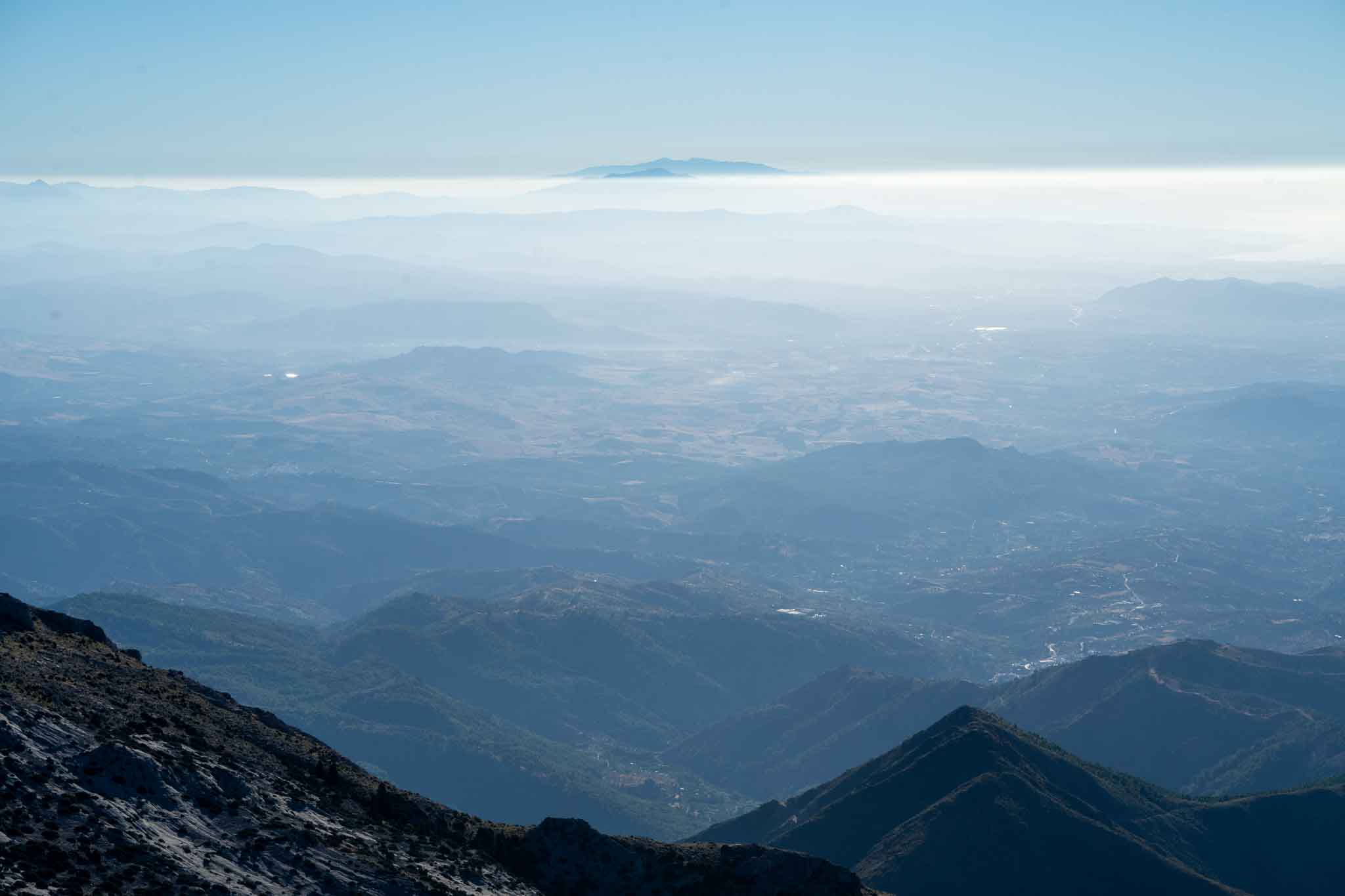
Mulhacen off in the distance
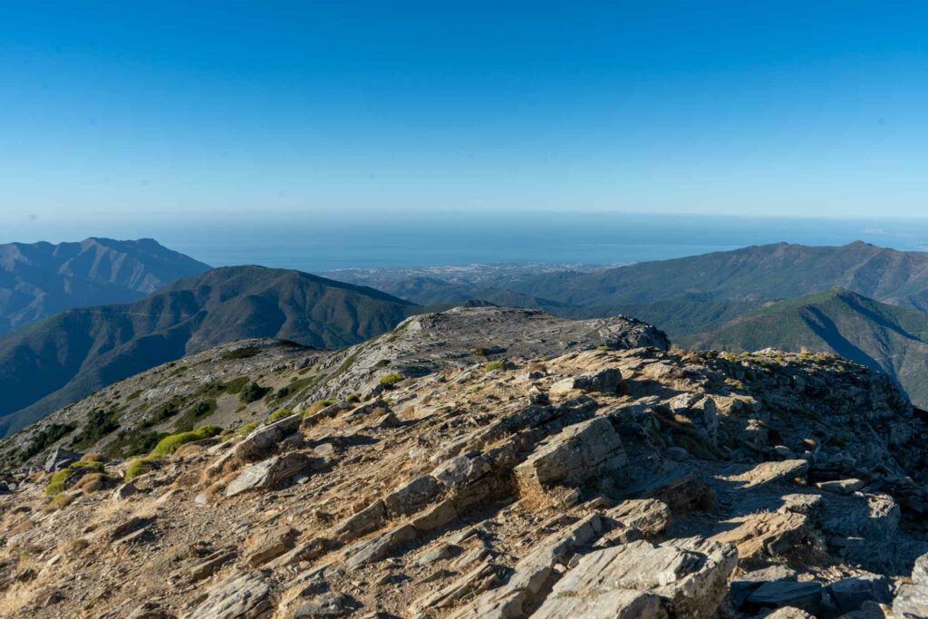
Looking towards the Strait of Gibraltar and the Atlas Mountains
Max DesMarais is the founder of hikingandfishing.com. He has a passion for the outdoors and making outdoor education and adventure more accessible. Max is a published author for various outdoor adventure, travel, and marketing websites. He is an experienced hiker, backpacker, fly fisherman, backcountry skier, trail runner, and spends his free time in the outdoors. These adventures allow him to test gear, learn new skills, and experience new places so that he can educate others. Max grew up hiking all around New Hampshire and New England. He became obsessed with the New Hampshire mountains, and the NH 48, where he guided hikes and trail runs in the White Mountains. Since moving out west, Max has continued climbed all of the Colorado 14ers, is always testing gear, learning skills, gaining experience, and building his endurance for outdoor sports. You can read more about his experience here: hikingandfishing/about
An incredible peak on an incredible day.
Trail was in perfect shape on this day. My better half and I hiked up together for my first time ever. This is a mountain that is close to her heart and has some incredible memories from her childhood. I feel so grateful for having been able to visit this place with her. Summit all to ourselves.
Visibility was interesting as there was a layer down low preventing great visibility, but we could see the tips of the Atlas mountains, and all the way to Mulhacen on this day.